


 Categories
Monsoon 2025 rains lash North India! IMD issues Red Alert in Uttarakhand, Orange Alert in Himachal Pradesh. Delhi-NCR records over 110mm rainfall, leading to traffic snarls and waterlogging. Check impacted districts, rainfall data, and IMD forecast
Rain lashed in many parts of the country on Sunday as India’s annual monsoon rains reached nine days earlier than is typical, the weather department said. In a typical year, rains lash the southwestern coastal state of Kerala around June 1 and move northwards to cover the entire country by July 8, according to the Met Department.
For Monday, IMD predicted heavy to very heavy rainfall very likely at isolated places over Bihar, Chhattisgarh, East Madhya Pradesh, Haryana, Chandigarh and Delhi, Himachal Pradesh, Madhya Maharashtra, Odisha, Punjab, Uttar Pradesh, Uttarakhand and Vidarbha.

The IMD has issued a red alert for extremely heavy rainfall accompanied by thunderstorms on June 30 across several Uttarakhand districts, including Uttarkashi, Rudraprayag, Dehradun, Tehri, Pauri, Haridwar and Nainital. In response, authorities temporarily halted the Char Dham Yatra for the safety of pilgrims, which has now been lifted. In Himachal Pradesh, an orange alert has also been issued warning of light to moderate rainfall at many places in the districts of Bilaspur, Solan, Shimla, Sirmaur, Hamirpur, Mandi, and Kangra, with a few spells of intense to very intense rainfall likely to occur at isolated places.
IMD has issued an orange alert for various districts in Punjab including Patiala, Sangrur, Ludhiana and Rupnagar, where very heavy rain with thunderstorm and lightning is expected. On Sunday, the Chandigarh was hit with heavy rains with 119.5 mm rain recorded till 8.30 am on Sunday, which also led to heavy waterlogging across the city.
The southwest monsoon arrived in Delhi on Sunday, simultaneously covering the entire country nine days ahead of schedule. This was a rare meteorological convergence that has occurred only five times since 2001.
For Monday, IMD issued an orange alert with a prediction of thunderstorm and lightning in Delhi and adjoining cities.
For northeast India very heavy rainfall is likely to persist over Arunachal Pradesh, Assam and Meghalaya, Nagaland, Manipur, Mizoram and Tripura during July 2 to 5.
The monsoon of 2025 has arrived with full intensity in North India, bringing a mix of much-needed rain and dangerous weather conditions.
The India Meteorological Department (IMD) has issued Red Alerts in Uttarakhand and Orange Alerts in Himachal Pradesh as torrential rainfall threatens to disrupt normal life.
Meanwhile, Delhi-NCR received over 110mm of rain within 24 hours, leading to widespread waterlogging, traffic snarls, and disruptions across the region.
The IMD has sounded the alarm for several northern states, warning of very heavy to extremely heavy rainfall over the next 48 hours.
- Districts affected: Dehradun, Nainital, Pauri, Rudraprayag, Chamoli, and Tehri
- Expected rainfall: 200mm+ in isolated areas
- Risks: Flash floods, landslides, river swelling
The IMD has warned of intense downpours across the Garhwal and Kumaon regions. Officials are urging residents to avoid non-essential travel, particularly in hilly and landslide-prone zones.
- Districts affected: Mandi, Kullu, Chamba, Kangra, and Shimla
- Expected rainfall: 100–150mm in 24 hours
- Risks: Road blockages, landslides, mudslides
Tourists have been advised to stay away from riverbanks and high-altitude treks as the hilly terrain becomes increasingly dangerous under heavy rain.
These states may see moderate to heavy showers over the next few days, accompanied by strong winds and isolated thunderstorms.
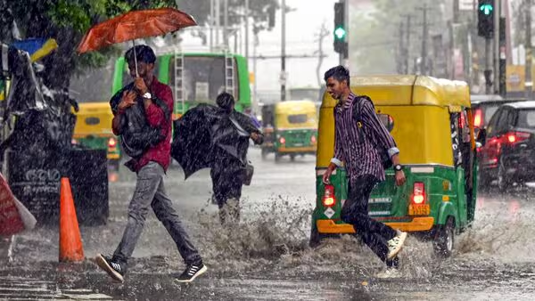
The national capital region woke up to a deluge on Monday morning, with rainfall crossing the 110mm mark at the Safdarjung observatory, the city’s main weather station.
- Waterlogging in major areas: Lutyens’ Delhi, Connaught Place, South Extension, and Noida Sector-62 were all heavily waterlogged
- Traffic chaos: Major roads like the Ring Road, NH-8, and Barapullah corridor saw snarls up to 3 km long
- Metro delays: Blue and Yellow lines reported minor slowdowns due to flooding at entry points
Visuals from Connaught Place and ITO showed waist-deep water in underpasses, bringing back memories of 2023’s monsoon havoc. Delhi Traffic Police issued advisories urging commuters to avoid specific routes until drainage operations were completed.
| City/Region | Rainfall (last 24 hrs) | Alert Level |
|---|---|---|
| Delhi (Safdarjung) | 110mm | No Alert (Urban Impact) |
| Gurugram | 92mm | Moderate Rain |
| Noida | 87mm | Waterlogging Risk |
| Dehradun | 144mm | 🔴 Red Alert |
| Nainital | 138mm | 🔴 Red Alert |
| Shimla | 98mm | 🟠 Orange Alert |
| Mandi | 103mm | 🟠 Orange Alert |
State and central authorities have swung into action:
SDRF teams deployed in Chamoli, Rudraprayag, and Tehri
Temporary suspension of Char Dham yatra due to landslide threats
Evacuation orders in low-lying zones of Haridwar and Rishikesh
Tourists advised to avoid Rohtang Pass, Spiti, and Lahaul
NH-5 and NH-707 partially blocked due to falling debris
Local panchayats instructed to stock essential supplies
NDMC and municipal bodies on high alert
Emergency pumps deployed to drain water from underpasses
Helpline numbers issued for traffic and civic emergencies